How can they harm our landscape and heritage?
 By Rose Lister
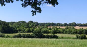
When driving down the A2070 on the Eastern edge of Ashford you may notice the startling juxtaposition of industrial and retail buildings on the one side and a beautiful rural landscape on the other. You may be saddened to discover that this rural idyll presided over by the stunning Grade I listed St Mary’s church has been earmarked for employment development.
‘Surely not!’ I hear you cry. ‘The rural church is set in rural surroundings, how can they be so harmful to our built and landscaped heritage?’ Unfortunately they can -the details can be found in the U19 policy and on the Ashford Borough Council’s (ABC) planning website. Our job is to ensure that everything that can be done to limit the harmful impacts of the site on the countryside and everything contained within it (man-made or living) is done. The current masterplan is a dull and uninspiring creation that has not currently been accepted by ABC. The little detail the masterplan has includes seven units of varying size, from large to massive, with suggested landscaping, new road links and parking. I shall be honest, these buildings are not to my taste. Their size, scale and suggested building material are unsustainable and harmful to the historic and living landscape, and that’s even before we consider the transport issues.
Heritage and Design
The Heritage Impact Assessment that was submitted with the application is severely lacking. The main argument within the document was focused on how the site is currently surrounded by the A2070 (to the West), the M20 (to the North) and the Channel Tunnel Rail Link (to the South) and therefore already irrevocably damaged. CPRE found that this wasn’t the case.
Design wise the masterplan suggests large white boxes of varying heights and unsympathetic materials. Not only would these have a negative impact on the immediate area and the heritage assets within but on the wider landscape including the wider setting of the Kent Downs Area of Outstanding Natural Beauty (AONB).
Environment
Indeed the AONB appears to have been largely ignored throughout the application. The damage to the significance of the setting demands that more must be done to conserve the wider setting of this natural asset. This aspect was given great weight with appeal decisions at the Waterside Park development site near Maidstone leading to the dismissal of the application.
In terms of wildlife the mitigation that is suggested is supremely inadequate. The local wildlife surveys in and around the site found bats, slow worms, grass snakes, common lizards and water voles. Needless to say some of these are protected or endangered species. The suggested masterplan makes no effort to reduce light pollution or make provision for the wildlife colonies in the area.
Infrastructure
As presently presented the masterplan shows detailed road plans with a focus on the Grade I listed church next door and the high pressure gas main that runs under the site. There is no insight into how the site will operate including cross docking, delivery, lorry turning areas, lorry parking (while waiting for time slots and taking breaks) and collection slot management. There is no reference to the cross channel ports nearby or how the site would be affected by Operation Stack. In all it makes for a concerning read.
Other Concerns
Much of the supporting evidence for the application makes suggested opening times of Monday to Friday 8am-6pm and Saturday 8am-1 pm. As at least one of the Units has been highlighted for a retail company these timings do not reflect the current economy. Also with two of the units being so large this limits their appeal to larger companies who work all ours of the day and night.
Another concern is the loss of rural lanes that currently surround the site. It is proposed that these lanes are widened to accommodate increased traffic numbers and a significant change in vehicle types. Is this a necessary evil? To sacrifice our rural character on the alter of commerce and economy?
The Village of Mersham is the sites closest neighbour. To prevent the town swallowing the village there needs to be a concerted effort to limit the extended expansion of Ashford.
Understandably CPRE are against the application as it stands. In our view it is unsustainable and harmful to the local environment. When considered against the NPPF the adverse impacts of the development clearly outweigh the benefits. It is clear that the masterplan site layout and design fails to identify, minimise and mitigate the harmful impacts.
Read our news story here.
The full response to the application is available here.
- A number of important documents have yet to emerge. For example, a rigorous transport plan and a finalised air-quality assessment. The latter is critical given that allocations at Teynham will feed extra traffic into AQMAs.
- There seems to be no coherent plan for infrastructure delivery – a key component of the plan given the allocations being proposed near the already crowded Junction 7.
- There seems to have been little or no cooperation with neighbouring boroughs or even parish councils within Swale itself.
The removal of a second consultation might have been understandable if this final version of the plan were similar to that being talked about at the beginning of the consultation process. It is, however, radically different in the following ways:
- There has been a major shift in the balance of housing allocations, away from the west of the borough over to the east, especially around the historic town of Faversham. This is a move that raises many concerns.
- A new large allocation, with accompanying A2 bypass, has appeared around Teynham and Lynsted, to which we are objecting.
- Housing allocations in the AONB around Neames Forstal that were judged “unsuitable” by the council’s own officers have now appeared as part of the housing numbers.
- Most of the housing allocations being proposed are on greenfield sites, many of them on Grade 1 agricultural land – a point to which we are strongly objecting.
Concerns about the rush to submit the plan
The haste with which the plan is being prepared is especially worrying given the concentration of housing in Faversham. If the town is to take a large amount of new housing, it is imperative that the policies concerning the area are carefully worked out to preserve, as far as possible, the unique nature of the town. The rush to submit the plan is likely to prove detrimental.
As Swale does not have a five-year land housing supply, it is open to speculative development proposals, many of which would run counter to the ideas contained in the current plan. Some are already appearing. This is a common situation, and one that, doubtless, is a reason behind Swale’s haste.
Our overriding fear, however, is that this emphasis on haste is ultimately going to prove counterproductive. This is because it is our view that the plan, in its current form, is unlikely to pass independent examination. We are urging Swale to listen to and act upon the comments being made about the plan and to return the plan to the council with appropriate modifications before submitting it to the Secretary of State.
Essentially, this means treating the current consultation not as the final one but as the ‘lost’ second consultation.
The consultation ends on Friday 30 April and we strongly urge residents to make their opinions known if they have not already done so.
Further information


