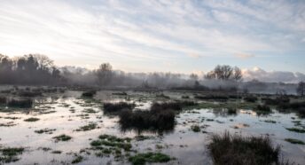
London Green Belt map launched
A new map of the London Green Belt, which covers a large part of west Kent, has been launched.
The Green Belt covers 93% of Sevenoaks, 77% of Gravesham, 71% of Tonbridge and Malling, 56% of Dartford and 22% of Tunbridge Wells. This is the first full and detailed account of the London Green Belt, and it is hoped the map will highlight the Green Belt’s importance to residents, at a time when it is under considerable threat from development.
The Green Belt is designated nationally with the purpose of maintaining openness between settlements to prevent urban sprawl out of London. The boundaries are set locally.
CPRE Kent Senior Planner Brian Lloyd said: “The Green Belt is under attack from developers with local authorities facing pressure to review the boundaries, but it is important to recognise how important it is to maintain a clear distinction between town and country and preserve the individual identity of villages and towns like Sevenoaks.”
The map was launched on November 5th by the London Green Belt Council and includes Green Belt boundaries, important historical sites, AONBs and constituency boundaries.
With the London Green Belt affecting the constituencies of approximately 70 MPs, the Council is seeking support from all political parties for its preservation, and so launched the map in the House of Commons.
Richard Knox-Johnston, of the London Green Belt Council and Vice President of CPRE Kent said: “We hope this new map will raise awareness of the importance of the Green Belt for safeguarding open spaces, as well as providing facilities for leisure and personal wellbeing.
“The London Green Belt is an essential part of our history, covering sites such as Runnymede, where the Magna Carta was signed, Charles Darwin’s House at Down, and the unique Saxon log church at Greensted near Ongar.
“Planning authorities must ensure that housing targets are not allowed to override the Green Belt. We urge politicians of all parties and the public alike to work to protect our Green Belt, and make sure that such protection is included in party manifestos.”
Eric Pickles, Secretary of State for Communities and Local Government, said:
“I welcome the hard work of the London Green Belt Council to help increase public awareness of the Green Belt.
“The Green Belt plays a valuable role in protecting against urban sprawl and providing a green lung around our towns and cities. The Government recently published revised planning guidance re-affirming the importance of Green Belt safeguards.”
- A number of important documents have yet to emerge. For example, a rigorous transport plan and a finalised air-quality assessment. The latter is critical given that allocations at Teynham will feed extra traffic into AQMAs.
- There seems to be no coherent plan for infrastructure delivery – a key component of the plan given the allocations being proposed near the already crowded Junction 7.
- There seems to have been little or no cooperation with neighbouring boroughs or even parish councils within Swale itself.
The removal of a second consultation might have been understandable if this final version of the plan were similar to that being talked about at the beginning of the consultation process. It is, however, radically different in the following ways:
- There has been a major shift in the balance of housing allocations, away from the west of the borough over to the east, especially around the historic town of Faversham. This is a move that raises many concerns.
- A new large allocation, with accompanying A2 bypass, has appeared around Teynham and Lynsted, to which we are objecting.
- Housing allocations in the AONB around Neames Forstal that were judged “unsuitable” by the council’s own officers have now appeared as part of the housing numbers.
- Most of the housing allocations being proposed are on greenfield sites, many of them on Grade 1 agricultural land – a point to which we are strongly objecting.
Concerns about the rush to submit the plan
The haste with which the plan is being prepared is especially worrying given the concentration of housing in Faversham. If the town is to take a large amount of new housing, it is imperative that the policies concerning the area are carefully worked out to preserve, as far as possible, the unique nature of the town. The rush to submit the plan is likely to prove detrimental.
As Swale does not have a five-year land housing supply, it is open to speculative development proposals, many of which would run counter to the ideas contained in the current plan. Some are already appearing. This is a common situation, and one that, doubtless, is a reason behind Swale’s haste.
Our overriding fear, however, is that this emphasis on haste is ultimately going to prove counterproductive. This is because it is our view that the plan, in its current form, is unlikely to pass independent examination. We are urging Swale to listen to and act upon the comments being made about the plan and to return the plan to the council with appropriate modifications before submitting it to the Secretary of State.
Essentially, this means treating the current consultation not as the final one but as the ‘lost’ second consultation.
The consultation ends on Friday 30 April and we strongly urge residents to make their opinions known if they have not already done so.
Further information


